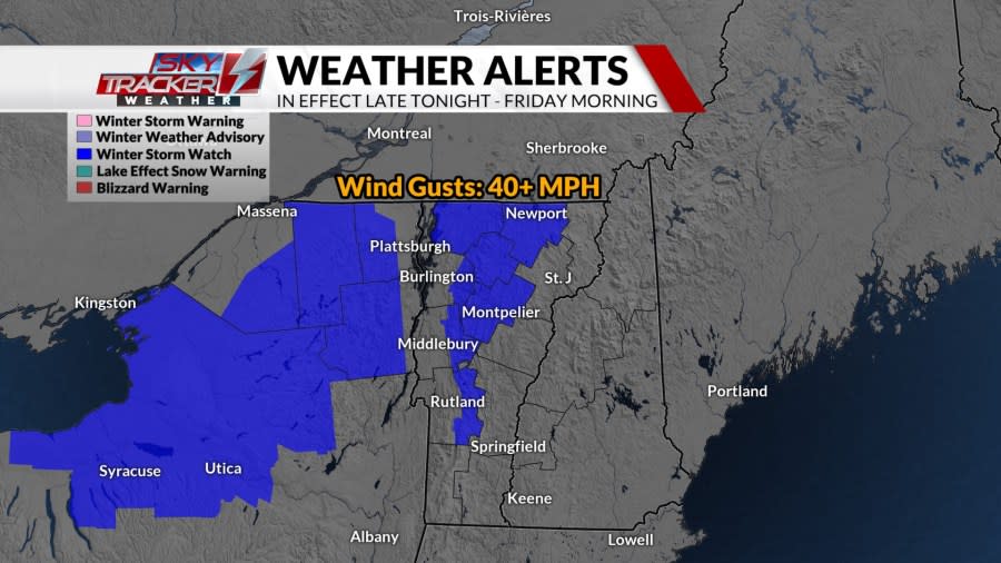
We have another elevation dependent snowfall event on the way for mid to late week. The snowiest day during this stretch will be Thursday with widely scattered snow showers in the valleys and steady, upslope snow for the mountains. Winter storm watches have been issued for parts of the North Country along with central and northern Vermont late tonight through early Friday morning.
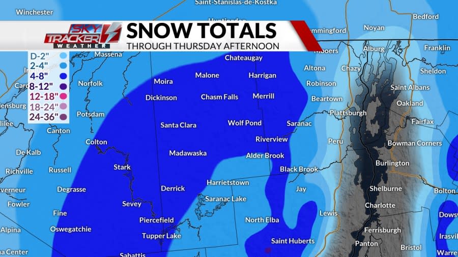
The North Country will experience snowfall totals of a dusting to 4 inches from the St. Lawrence River Valley to about 1,000 feet in elevation. Meanwhile, it’s a solid 4 to 8 inches for the mid to high slopes of the Adirondacks. Elevations of 2,000 feet or higher will cash in on 8 to 12+ inches.
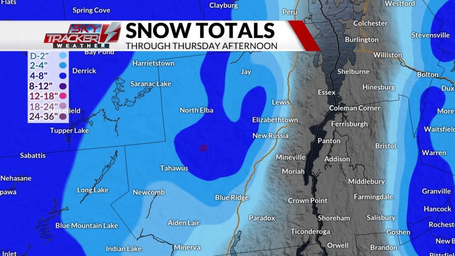
The Champlain Valley and most of the Connecticut River Valley will miss out on a hefty snowfall. It’s a dusting to 2 inches for both broad valley locations, but there could be localized 2+ inch amounts for parts of the northern Connecticut River Valley especially in the notoriously colder hollows. Outside of those broad valley locations, totals tick up to 2 to 4 inches from 500 to 1,000 feet. It’s 4 to 8 inches for elevations of 1,500 to 2,000 feet. The higher peaks and summits of 2,000+ feet will tally 8 to 12+ inches.

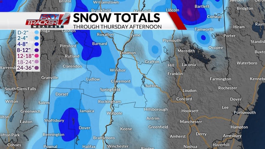
Lastly, southern Vermont and the Upper Valley will average minor snowfall totals of about a dusting to 2 inches. The mid-slopes of the southern Greens will add up 2 to 4 inches with the higher slopes, peaks, and summits getting into 4 to 8+ inches.
Copyright 2025 Nexstar Media, Inc. All rights reserved. This material may not be published, broadcast, rewritten, or redistributed.
For the latest news, weather, sports, and streaming video, head to ABC22 & FOX44.