DENVER (KDVR) — The Denver weather forecast is heating up heading into the weekend. Temperatures will be in the middle 90s Saturday, above average for the end of July. Next week could be even hotter with highs nearing the triple digits.
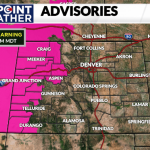
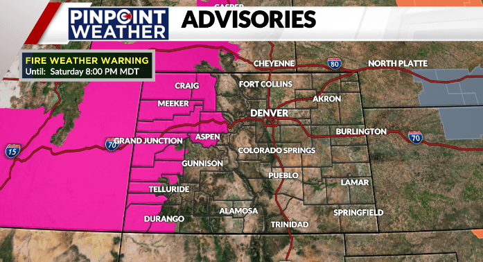
Some storms are possible across the eastern planes this afternoon, meanwhile along the western slope there is a Red Flag Warning in effect from noon until 8 pm. Outdoor burning is not recommended today.
Weather today: Sunny skies
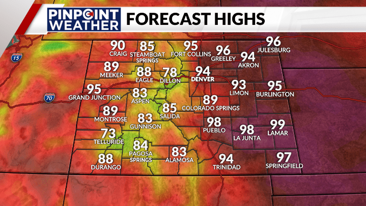
The weekend starts off with abundant sunshine and a light breeze. A few afternoon clouds could drift off the mountains and provide some shade to eastern plains communities. Temperatures are forecast to easily reach the low to mid-90s across northeast Colorado and metro Denver. The hottest readings will be in the southeast corner of the state with triple digits highs.
Weather tonight: Mostly clear
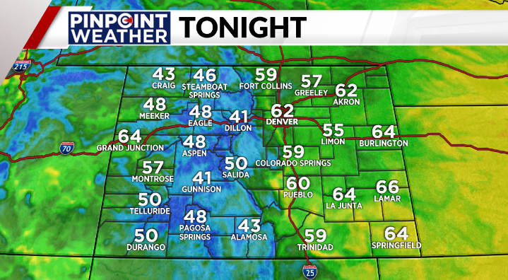
Clear skies dominate the area overnight as lows drop down into the middle to lower 60s. Winds will be out of the west anywhere from 5-15 mph with gusts as high as 20 mph.
Looking ahead: Rain returns with cooler outlook
The heat stay on Sunday and could reach the record of 98 degrees in Denver. The metro will start the work week in the hot 90s. However, with a little more cloud cover and a low chance for a stray shower or thunderstorm we will not chase the record on Monday of 100 degrees.
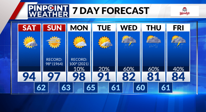
Monsoon moisture will head back to the state providing a better chance for afternoon showers and thunderstorms starting on Tuesday and lasting through Friday.
The best chance for rain will be on Wednesday and Thursday. And, with the showers back in the forecast, the high temperatures will once again cool into the 80s, which is below normal for this time of year.