Unfortunately, more rain and clouds are ahead this weekend as a front stalls nearby across the Florida Straits, trapping moisture across South Florida.
It won’t necessarily be a washout this weekend but it definitely won’t be dry! Expect passing showers and isolated thunderstorms both days this weekend with high temperatures struggling to reach the mid 80s. Otherwise, skies will remain mostly cloudy.

The clouds will hold with the chance for additional showers on Monday but we’ll start to notice improving conditions mid next week.
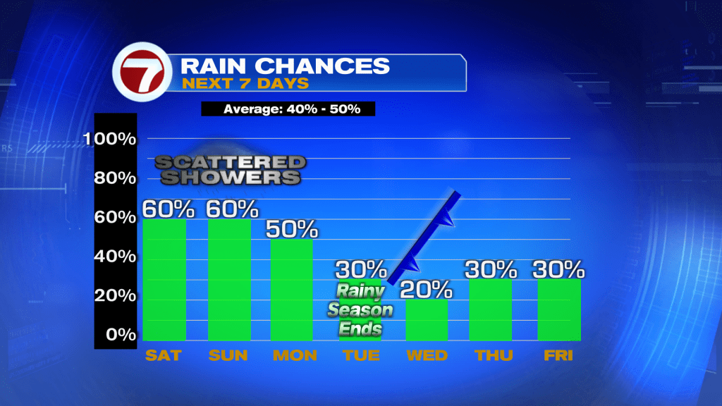
That’s because a fall front is forecast to move through on Wednesday, which should help clear out the moisture at first and usher in brighter conditions. This front is also expected to lock in milder temperatures once again.

Through Tuesday, highs are forecast to gradually rise into the mid to upper 80s before this front knocks it back down to the low to mid 80s. Late in the week with a strong, onshore wind, however, that will lead to the chance for additional showers flowing onshore at times.

Tropics update
There only remains Tropical Storm Leslie, which is forecast to lose its tropical characteristics over the weekend as it tracks near the Azores. There is also an area to watch near the Cape Verde Islands with a medium formation risk.