Takeaway of the Day
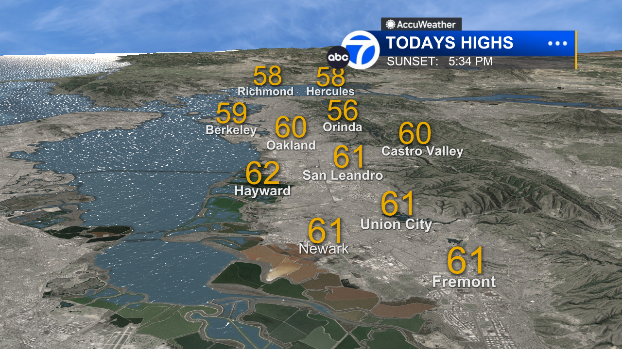
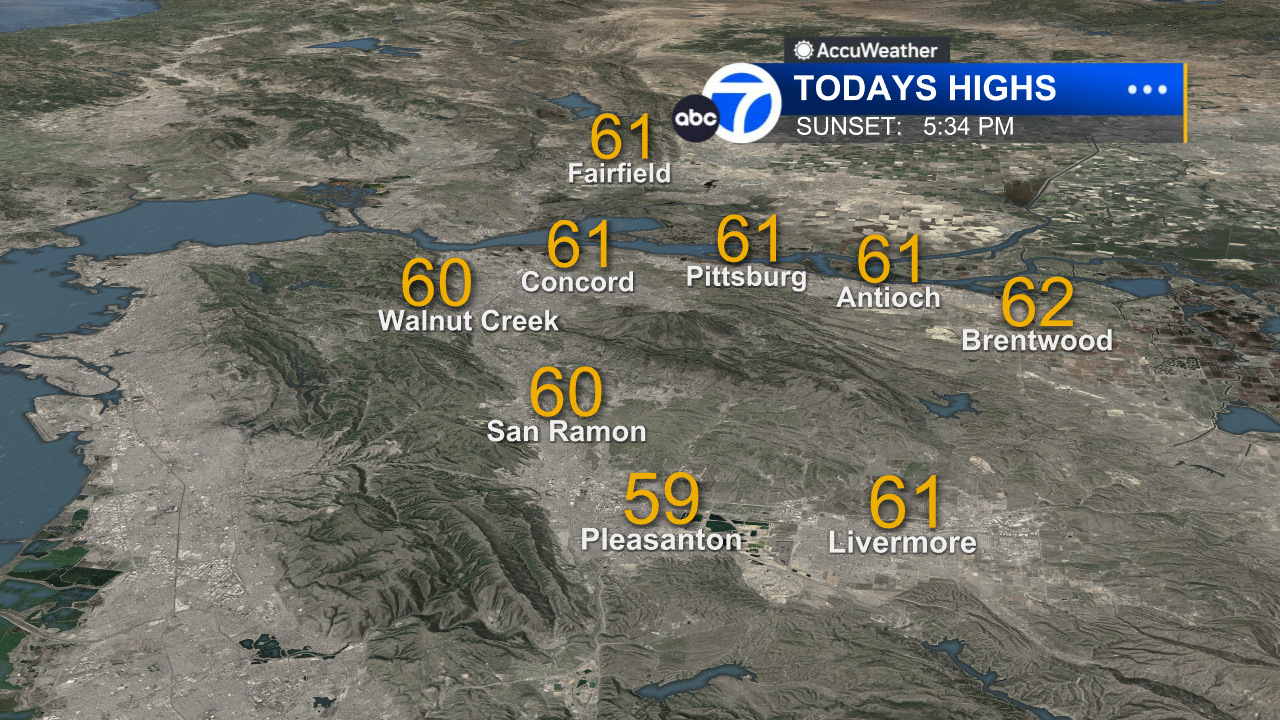
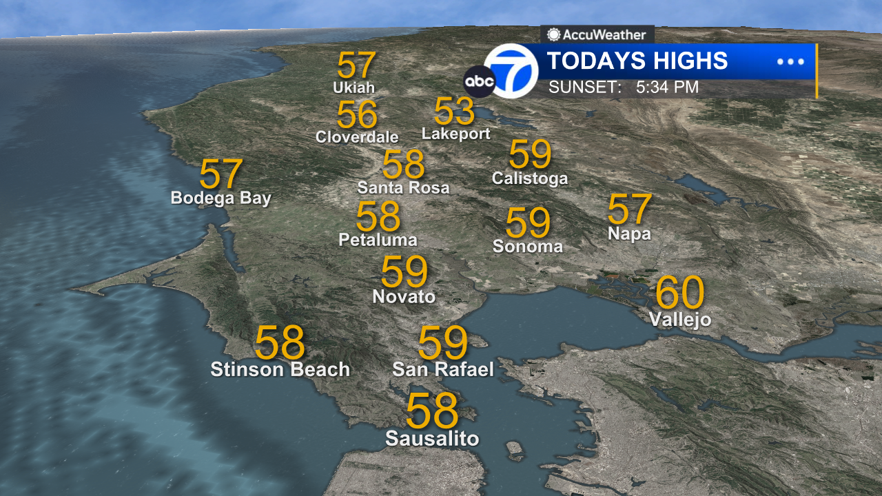
Our stormy weather pattern eased up a bit today as we experienced mostly light rain and showers. The steadiest and heaviest activity was mainly in the North Bay, although some locations south and east of the Golden Gate picked up a few hundredths of an inch of measurable rain. Going into the evening and nighttime hours, any additional rainfall will be mostly light and scattered. However, roadways will still be wet and slippery, and there remains a chance of minor localized flooding on creeks, streams and low-lying roads because of saturated soil.
The Look Ahead
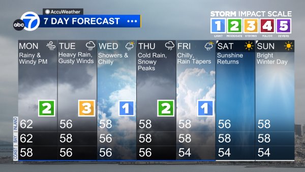
Our current rainy pattern is not likely to change until the end of next week. The Bay Area is in the path of a substantial atmospheric river, which will continue to generate a series of rainy, stormy days through Thursday and possibly Friday. Tomorrow and Tuesday, the rain will be heavier and more widespread, and it will be accompanied by gusty winds. At the moment, we are ranking tomorrow’s storm a moderate Level 2 on the Exclusive ABC7 Storm Impact Scale. Tuesday’s storm will likely be a strong Level 3. We should be prepared for increasing chances of localized flooding, downed tree limbs, power outages and slick roadways for at least the next five days.
7 Day Forecast
SHARE YOUR PHOTOS: We love seeing photos and videos from where you live! Share yours by posting with #abc7now. You must have taken the image/video or otherwise own all rights to it and agree that KGO-TV and its licensees can use, edit and distribute it without restriction in all media. Full terms: abc7news.com/share
Copyright © 2025 KGO-TV. All Rights Reserved.