ST. LOUIS – Temperatures have fallen into the low to mid-10s out the door Wednesday morning. Some clouds have rolled back in, slowing the drop off, but we’re still a good 10 degrees colder in spots from Tuesday morning.
Some sun later Wednesday, which will be good to clear off the roads, highs only in the low 20s. Another very cold night on Wednesday; wake-up temperatures Thursday will be between 0 and 10 F.
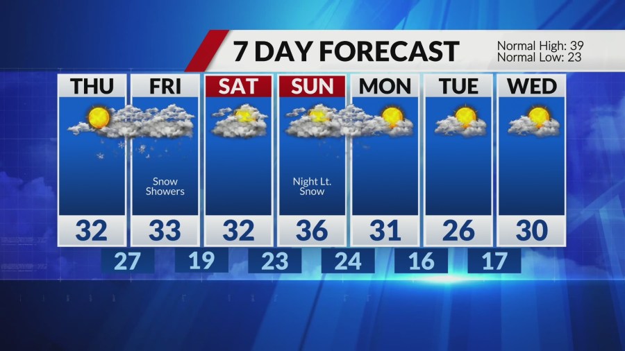
Increasing clouds Thursday, highs in the upper 20s to low 30s. A storm system is lifting out of northern Mexico and will move into the southern Plains Thursday. This will be a significant snow and ice maker farther south, but a less impactful storm for us than what we saw earlier this week.
That being said, it does look like this storm spreads light snow our way into Friday morning. Accumulation will be possible, especially south of I-44 in Missouri and I-64 in Illinois, where up to 2” is forecast. Metro St. Louis should be ready for light snow during the Friday morning commute and some minor accumulation.
Snow moves out Friday afternoon. Saturday looks quiet, but I am watching another chance of light snow late on Sunday.