EVANSVILLE – This is not 2009.
That was the message from National Weather Service Friday as the Evansville area braced for a winter storm that will sweep through the area this weekend.
During a conference call with media outlets, forecaster Rachel Trevino stressed the massive system, while serious, won’t be nearly as severe as the disastrous storm that struck the area 16 years ago. The 2009 debacle killed at least 35 people across the Midwest and left 700,000 Tri-State residents without power.
This weekend’s storm will arrive Saturday night and could linger until Monday morning, with the heaviest precipitation happening Sunday. And while it could cripple travel in the city for days, it won’t reach the levels of its awful predecessor.
“We’re not expecting a 2009 ice storm,” Trevino said. “The setup is very different.”
In ’09, there was a steady, constant rain that collected on every power line and tree branch it could find, sparking widespread power outages. This go around, it will be too breezy for the ice to collect in a similar way. But it still will accumulate on flat surfaces such as roads and sidewalks.
The NWS has ice amounts for Evansville anywhere from one-tenth of inch to a quarter-inch. Typically, only a third of the ice that falls is able to collect on power lines. So if Evansville got a quarter-inch, only less than one-tenth would linger on power lines.
“This will be a lot of travel impacts and some power outages,” Trevino said. “… But there will very likely be some power outages.”
In a bulletin earlier this week, the NWS was even blunter. Travel through the Evansville area, it said, could be “nearly impossible.”
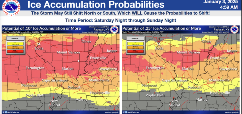
A graphic from the Paducah, Kentucky office of the National Weather Service shows the ice accumulation for Evansville as the area braces for a winter storm this weekend.
How much ice and snow will Evansville get?
Almost everything else about the storm is still somewhat up in the air.
NWS graphics had the northern portions of Vanderburgh County in a high probability of getting at least one-tenth of an inch of ice and a moderate chance of getting a quarter-inch.
Multiple storm models, however, still differ the kind of precipitation the area will get. Evansville sits in a spot between snow to the north and mostly rain to the south. If the low front shifts in either direction, the precipitation type will change.
Snow-wise, Evansville has a 40-50% shot of at least 2 inches and a 10-30% chance of at least 4 inches. Most of that snow would arrive after the ice sweeps out of the area Sunday evening.
“We are going to have impacts,” Trevino said. “Just how much your area is going to have is still in question.”
When will the storm arrive?
The NWS has the system reaching Southwestern Indiana and Northwestern Kentucky somewhere between 4 a.m. and 8 a.m. Sunday. That could shift as the storm lumbers across the U.S. As of Friday morning, it still lingered over the Pacific northwest.
“If we’re off a couple hours, sorry. We’re doing our best,” Trevino said. “This is a very complicated scenario we’re dealing with.”
Will the ice and snow stick around?
Yes. After the system exists, brutal cold will follow on its heels, draping the Tri-State in blasts of arctic temperatures. By Monday, wind chills in the city could drop as low as 13 degrees.
It’ll get even worse as the week wears on. Tuesday and Wednesday could see wind chills in the low single digits. Thursday, they could even dip below zero.
What should I do to prepare?
If you haven’t made your grocery store runs, now is the time. Ice-encased roads will make travel dangerous once the storm arrives.
The low temperatures also bring the risk of freezing pipes. You should leave faucets at a constant drip, especially those butted against outside walls. Any exposed pipes can be wrapped in insulation sleeves, and outdoor faucets can be shrouded in specialized bags or coverings.
The NWS also stressed that residents should use care with generators. Keep gas generators outside at least 20 feet away from your home. Failure to do so runs the risk to carbon monoxide poisoning.
Space heaters, meanwhile, should be placed on hard floors and kept clear of any laundry or blankets. Instead, use those extra blankets or towels to cover cracks in doors or windows – especially if you lose power.
“And once your family is safe, check your neighbors,” Trevino said. “Help people – because a lot of people, even when they prepare, aren’t as prepared as they want to be.”
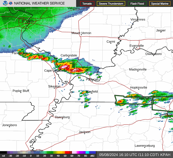
Evansville weather radar
This article originally appeared on Evansville Courier & Press: Will the winter storm heading to Evansville be as bad as 2009?